
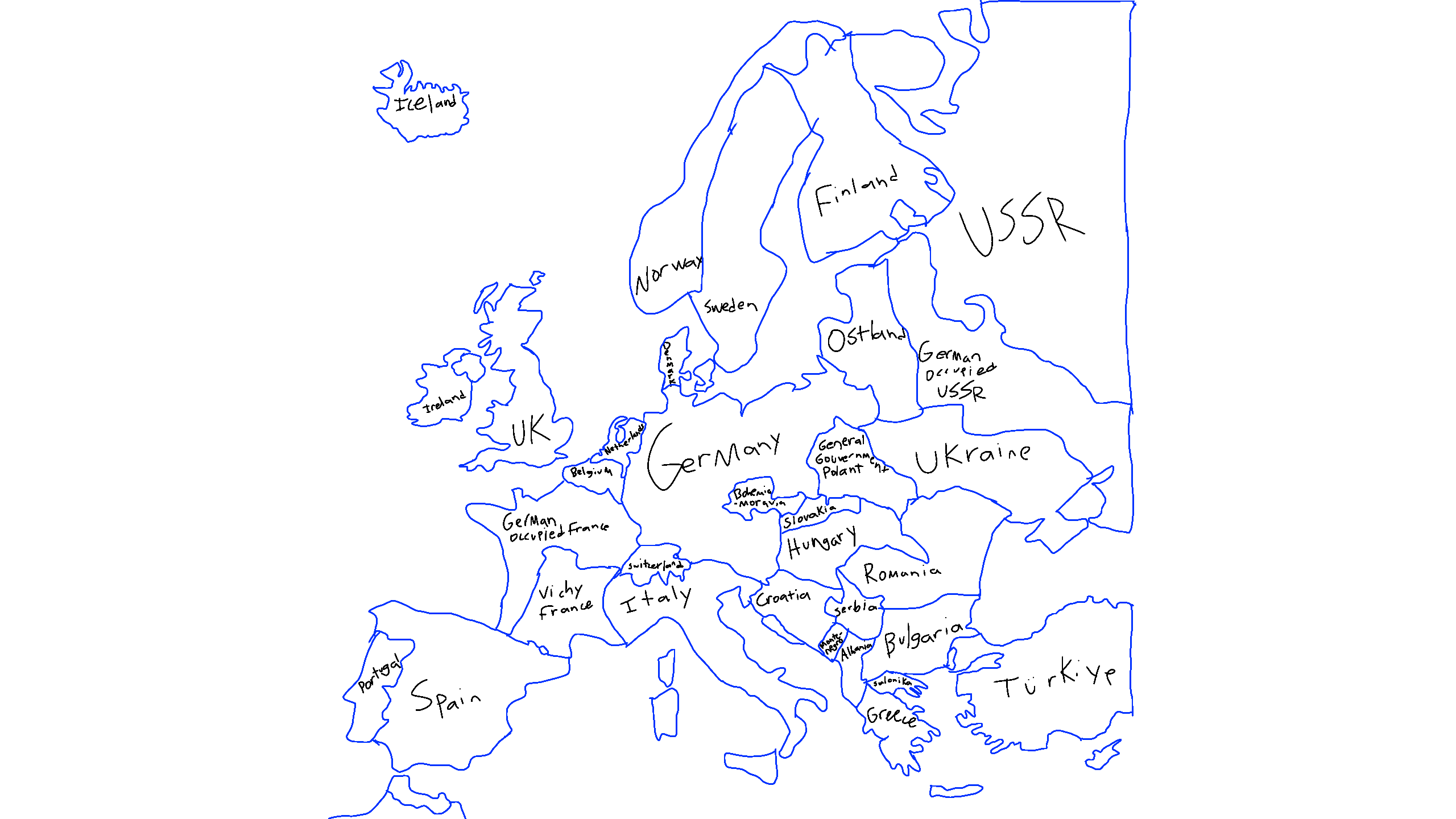
Europe 1942 (traced) by Kersephomy
(NOT TRYING TO OFFEND ANYONE THIS MAP IS SOLELY FOR EDUCATIONAL PURPOSES)
might be the last one traced for now
@CHEEZ13404 is this accurate?
@Linkk
@_-smoreZ-_
(reupload as i forgot to put name the Netherlands and Belgium)
Comments
5
like
reference image
eraser
eyedropper
time taken
nsfw
flip
undo
paint with friends
private
used tools icons
500
100
25
5
1
The comment has been reported
The Colors! Gallery moderators will look at it as soon as possible.
delete comment?
just delete
delete comment and prevent this user from commenting on your paintings
report as inappropriate
confirm
Comments
31 Dec, 2025, 7:44 pm
wow so cooooool :3
31 Dec, 2025, 7:45 pm
i'm in italy pizza, pizza mamma mia
02 Jan, 2026, 9:41 pm
this is mostly accurate though I would consider Ostland and Ukraine as part of Germany during this Era becase they had been taken by the German Military, aswell with Czechia i would Consider it as a german state aswell due to them being Annexed and all.
02 Jan, 2026, 9:42 pm
But if your just showing the other countries as 'states' that were taken by Germany at the time to not have germany look like a tumor on europe, then yes, it is mostly accurate.
02 Jan, 2026, 9:43 pm
(also im pretty sure Turkiye was called Turkey at that time.)